Think of cities as a device. A device that extracts labor and resources while also dispossessing the people who provide that labor. But who controls this device? And how has it been wielded over the years, decades, if not centuries? The city is an artificial product, but it is also a powerful instrument that facilitates extractive processes. The city primarily serves the state, an entity created and nurtured by elite in order to maintain their status, class, and most importantly, their accumulated wealth. The foundations of this device developed as early as the 1200s within the early kingdom of England. The Spanish Empire expanded it in what is today Caracas in the 1500s.
The Spatial Production of Race and the Property Control of Gender

Key Findings
- The gendered relationship and control of private property begins in the imperial city.
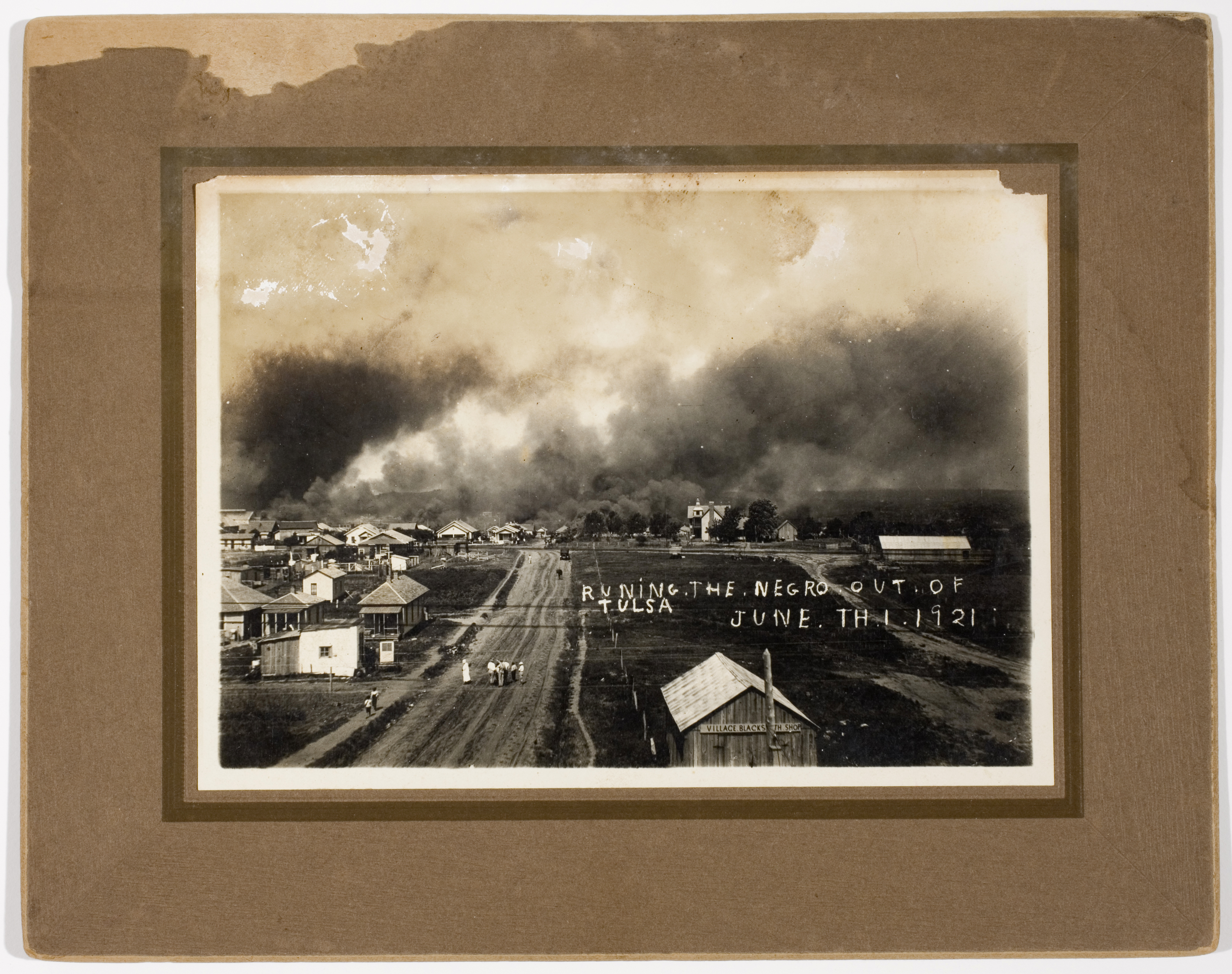
- The racialized concentration of populations begins and developed by elites in colonial cities.
- Intensive international archival research of maps, laws, and other documents is coupled with present-day on-the-ground field work in cities in every continent to show that foundations and models from the past are very much alive today. The colony never ended, and imperialism never went away.
The City as a Geography of Threat, A Premise
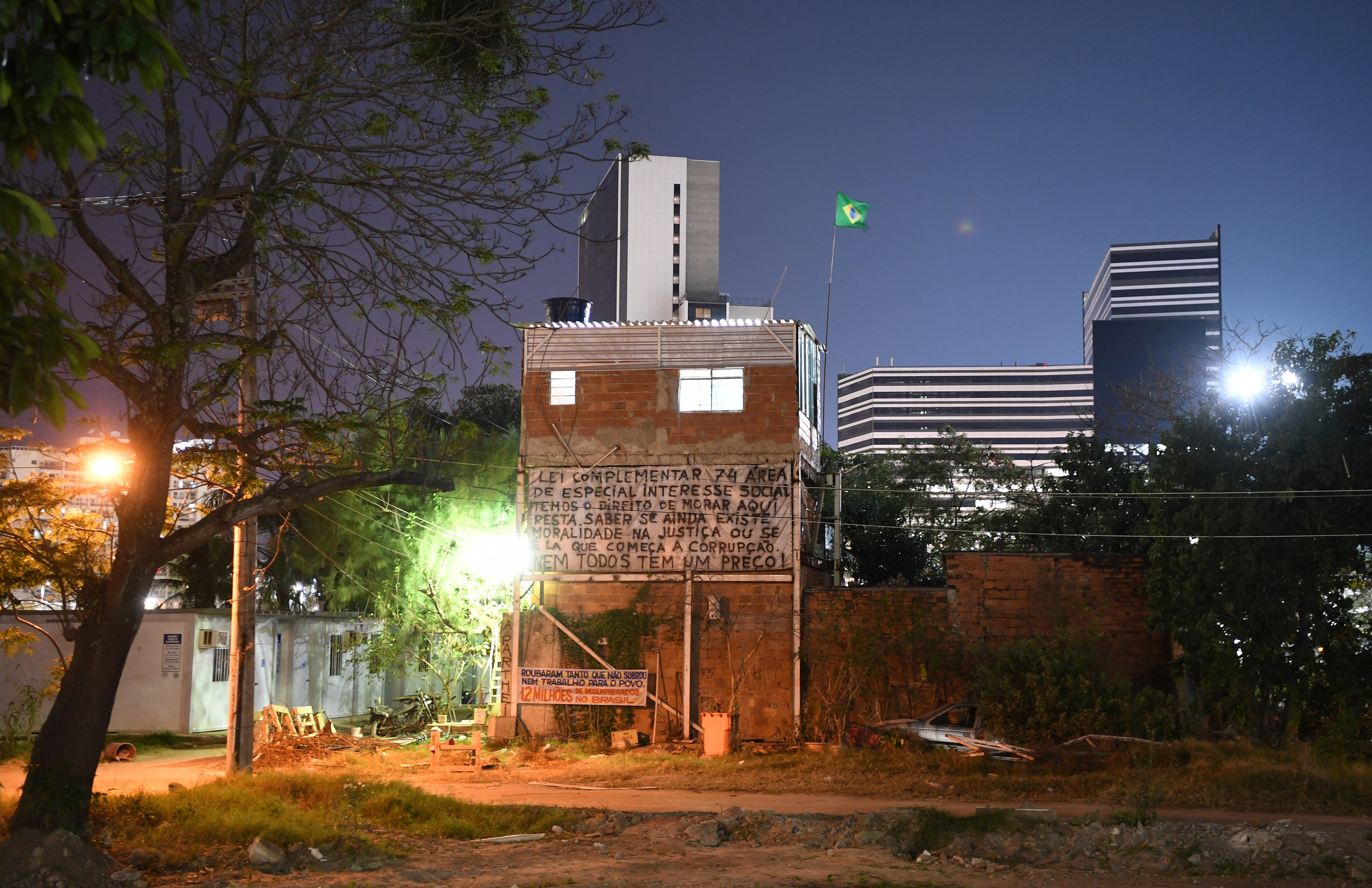
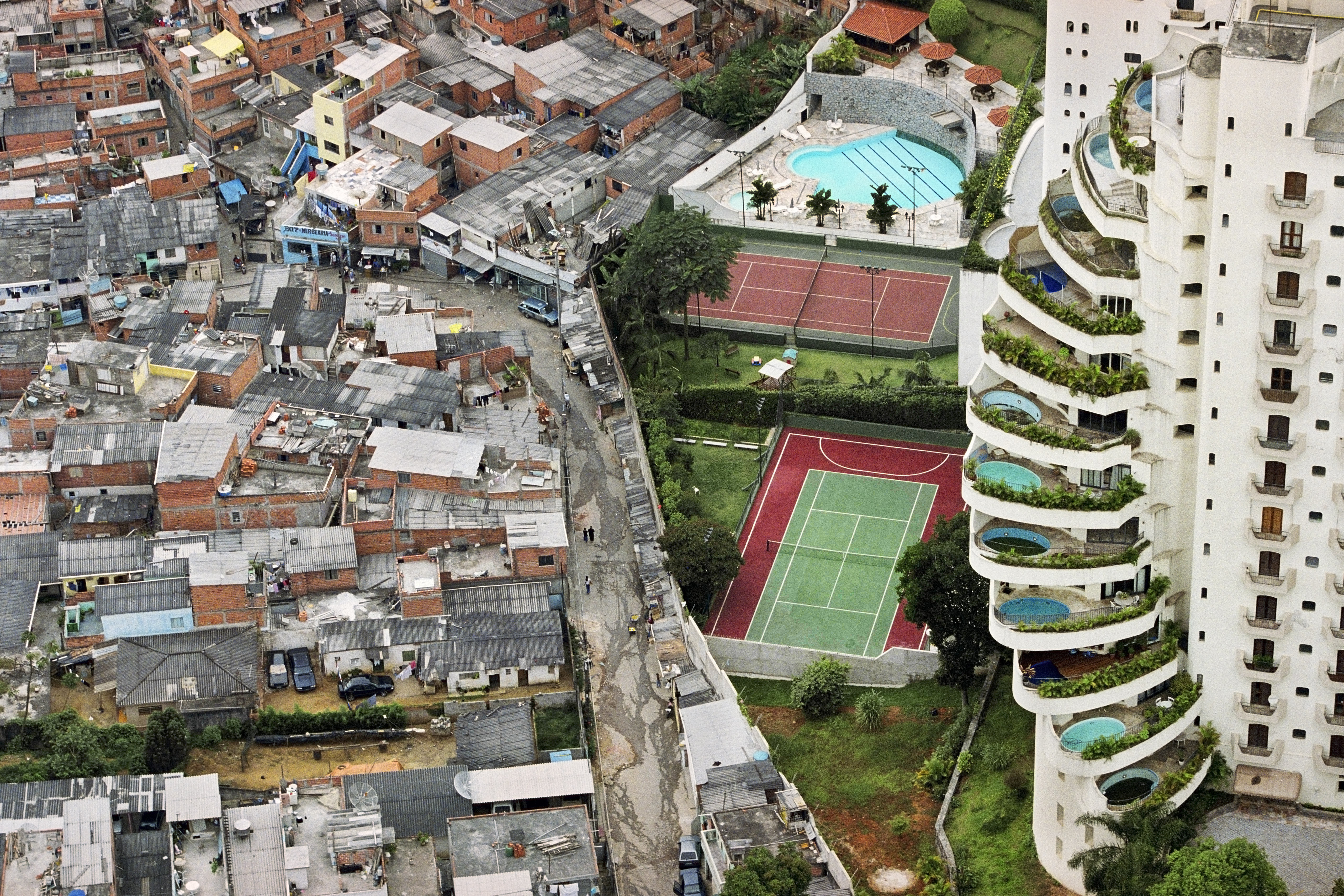
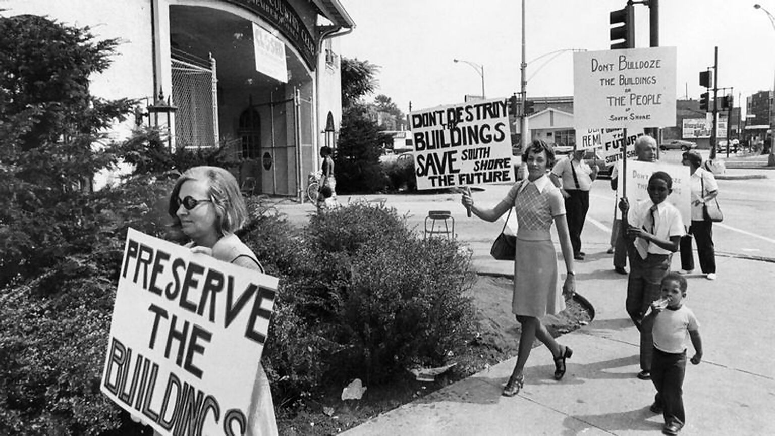
The work here presents a story of how cities fail to fulfill promises of property, home, and health to its residents. Failed states begin at the level of failed cities. This failure lies within the provision of any modicum of basic needs, not to mention civil expansion and creative fulfilment of those basic needs and human rights. As a result, states have never failed in their intent and function. Space is fundamentally political, and the development of the city is the cohesive expression of state power in order to control the divisions of labour along class, gendered, and racialized lines. In other words, failure was, and is, the point.
The Geography of Threat as a Concept
This sets the stage for conceptualising the very functional purpose of the State through its cities as “The Geographies of Threat”: 1) the identification of populations; 2) the identification as threats; and 3) the identification for violence. Without the spatial features and functions of cities, class, gender, race, and state power would not exist as we know it. Harkening back to the period of transition from feudalism to capitalism, from local authoritarianism to global colonialism, the roots of the city are inextricably tied to the state expansion. The idea of historical recurrence (“history repeats itself”) is engineered by the State to instil social acceptance and complicity. The State wields the power that the populace gives it. State power holds dominion over its populace and is always concerned with never losing its grip on that control. Racialised identities manifest in relation to people’s position within the State (as colonizer or colonized in the colonial city project; the various class structures, statuses, racial categories, or gendering role/function), and constitutes a primary means of spatially organizing social life.
The Geography of Threat as an Outcome
Through governance, a fabricated society was/is constructed with a clear spatial reasoning in place through privatizing housing and localized zoning. Zoning legally, socially, and eventually legislatively through local ordinances, assisted a structure of (planned) exclusion, (zoned) concentration, and (“slum” clearance) removal in cities. City infrastructures systematically oppress (gendered) women and systematically eliminate racially “Othered” (and gendered) men. And so, patriarchy and racial supremacy within the State are disruptions to an alternative socio-political life. The basic principle for cities to be at their maximum potential as a sphere of operation is that they must regularly assess, identify and abandon things that are no longer profitable to the maximization of the future, thus they are essential to the work of state violence.
Conclusion
In the city, new possibilities of destitution have created new possibilities of re-imagination. Control of the city is the locus of struggle between State power and dissenting power. The modern city’s schema combines the empty city freed of indigeneity; the closed city of restricted access; the colonial city with planned congregations of the racial “Other”; the imperial city renovated with racial and gendered city splitting; the Stateless-beyond-city of the rural and through ‘hood abandonment; the dead city that is prison; the revanchist city of gentrification; and the possibilities of the old, walled fortress city and the new, selective private city. All of these combine to yield the eventual production of the apartheid city of confinement and restrictive order. Theapartheid city is the state’s ideal geographical and spatially necessary response to the current and coming phenomenon of overpopulation, overaccumulation, and over-carcerality.The city has historically identified and situated populations into their proper place in service to the social order. In the milieu of deracination, abandonment, dereliction, dispossession, and violence, there is the possibility of an abolitionist geography of possibility and wondrous imagination, a soul city or free city.
All that is between us is the city.
Meet the Researcher
Rasul A. Mowatt was formerly a Professor in the Departments of American Studies and Geography of the College of Arts + Sciences who focuses on violence and cities. Rasul holds Affiliate Status for the Center for Research on Race and Ethnicity in Society, the Department of African American and African Diaspora Studies, and the Ostrom Workshop. Rasul was also a Professor in Parks, Recreation, and Tourism Studies in the School of Public Health, Bloomington. Currently, Rasul is the Department Head in the Department of Parks, Recreation, and Tourism Management in the College of Natural Resources at North Carolina State University.
This work was partially funded by the Center for Research on Race and Ethnicity in Society and is available through Routledge, entitled The Geographies of Threat and The Production of Violence: The State and City Between Us.